
blah blah blah
King Ravine
Length: 8.2 miles out-and-backDifficulty (click for info): Very Hard
Elevation Gain: 2600 feet (+260 feet on return)
Rating (click for info): 9/10
Elevation: 3700' (trail jct at ravine floor)
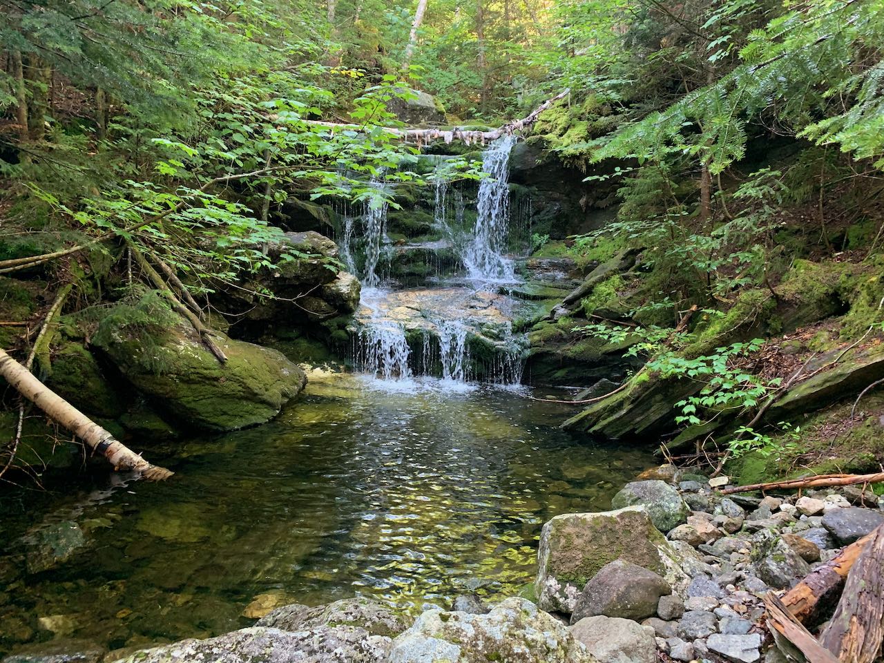
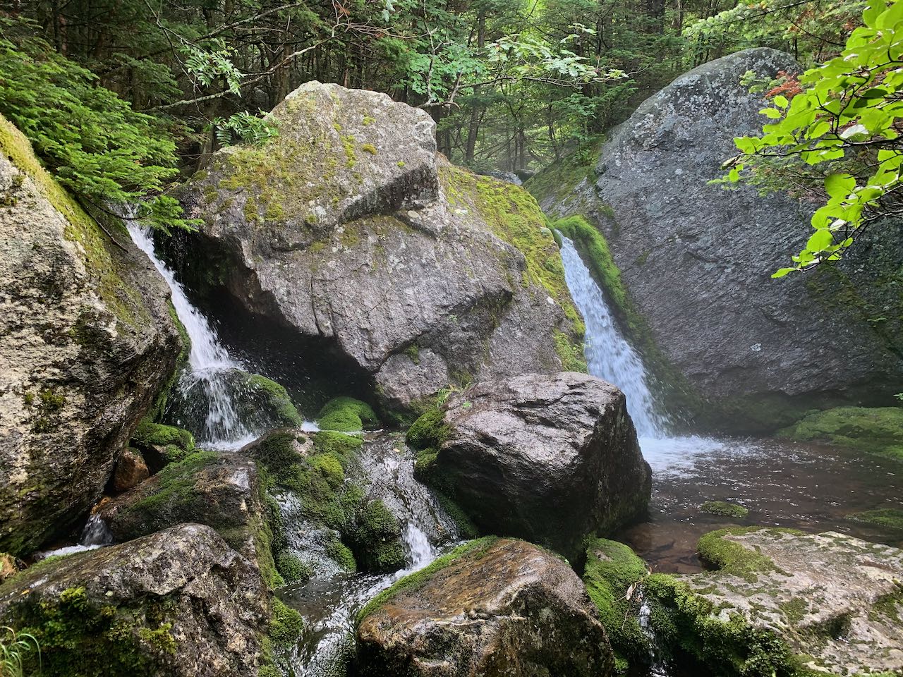
Height: 10' (Canyon) and 10' (Mossy)
Driving Directions:
Trailhead and parking area are on Rt. 2 in Randolph, NH (destination is in Low & Burbanks Grant). The trailhead is located on the south side of the road, but parking is only available in the lot for the abandoned Lowe's Store, on the north side of the road, 0.1 miles east of the trailhead. This is 5.1 miles east of Rt. 115 and 7.4 miles west of Rt. 16 in Gorham. Click here for a Google map.
About the Hike:
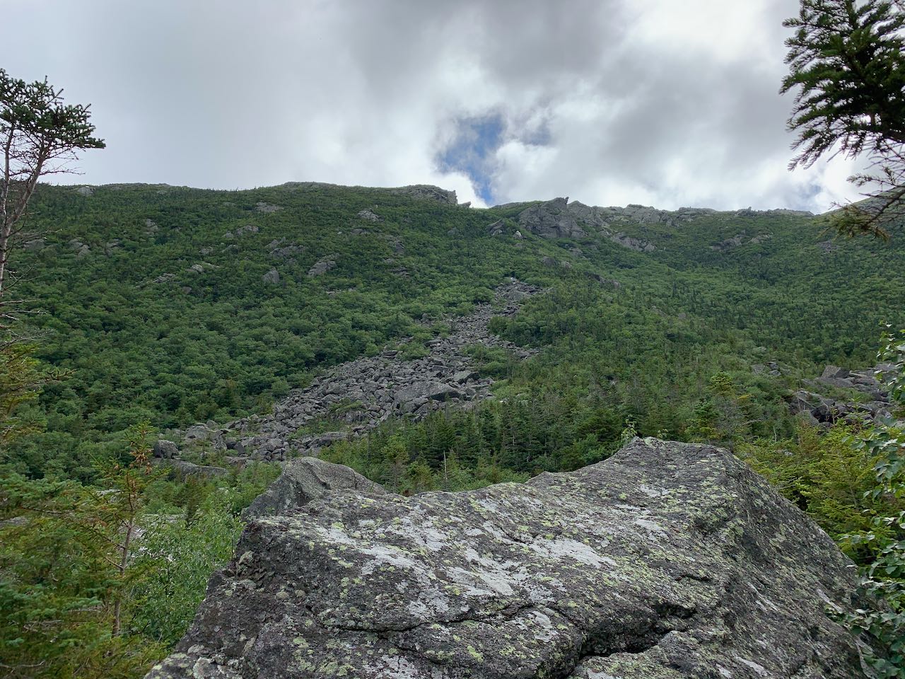
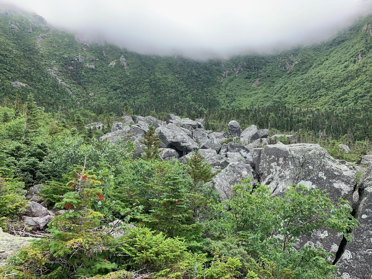
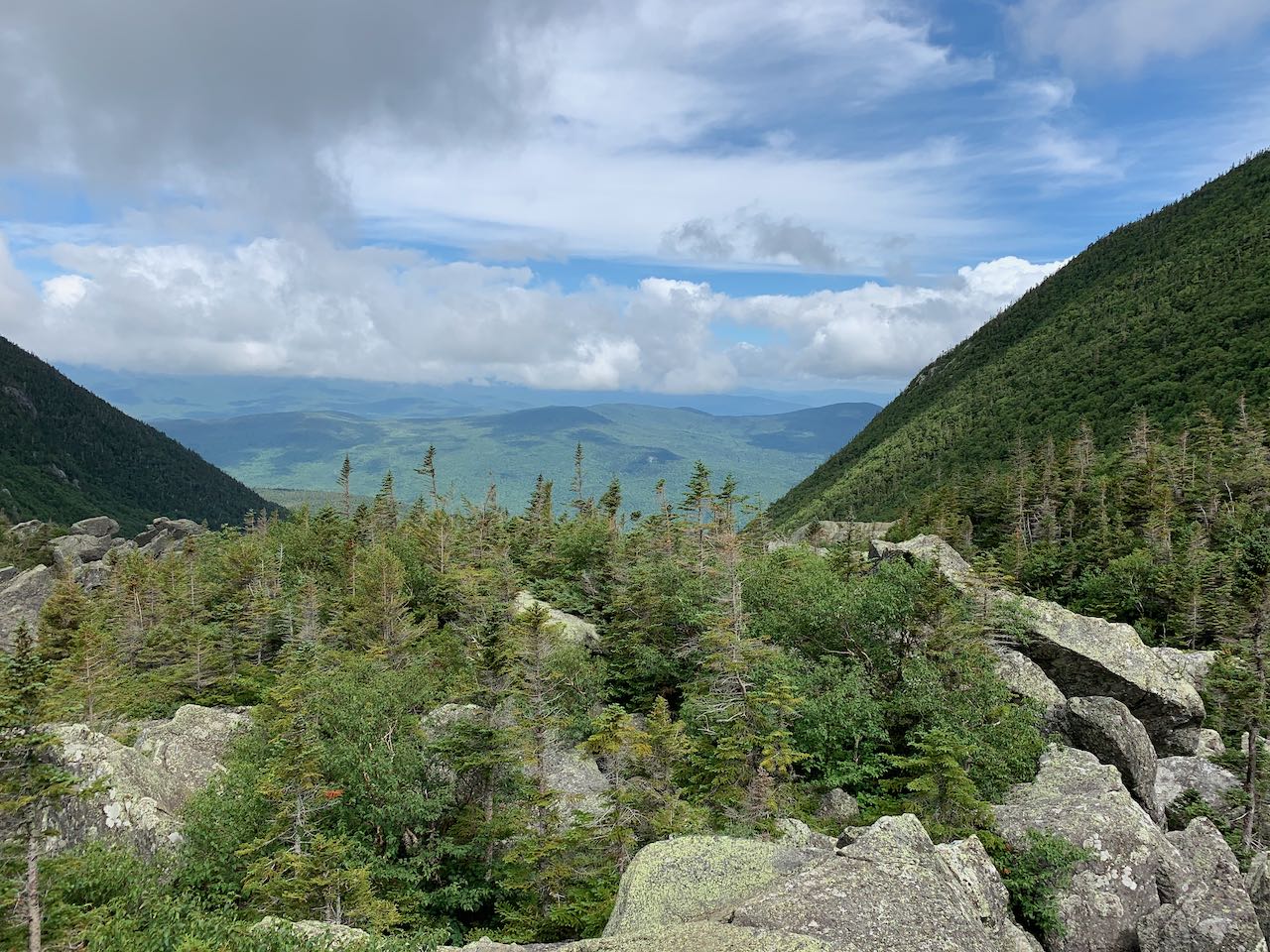
The Presidential Range is famous for its glacial ravines. With intensely steep terrain, tortured rock slides, craggy cliffs, and abundant waterfalls, they provide some of the most challenging and exciting routes to the northern peaks. There are a few options for experiencing the grandeur of the ravines without committing to the full trip up the headwall of one of them, but none brings you face to face with the spectacular mountain majesty quite like the trip into the floor of King Ravine. The bottom of the great valley is piled with boulders that scar the landscape and open it up with mesmerizing sights of the ravine walls. It's a challenge to reach, as you'll have to contend with the unfriendly jumble of boulders scattered across the landscape, but once you attain the floor of the ravine, the harsh terrain becomes a platform from which to enjoy the views of not only the ravine itself but also out to the northern Whites. On the approach to the ravine, you'll encounter a pair of mystical, lush waterfalls on the streams draining from the lofty slopes of Mt. Adams. These just add another element to the adventure.
Starting from the abandoned Lowes Store and gas station, head west down the road, crossing the entrance to Durand Road on the way. After 0.1 miles, cross the road toward the hiking sign at the entrance to the trail. Enter the forest and pass by a kiosk and historical marker commemorating the building of this late-1800s era trail, whose namesake's descendents still roam the White Mountains today. 0.15 miles into the woods, the trail crosses a powerline clearing. The trail runs gradually uphill under deciduous tree canopy, then becomes a bit steeper as it ascends stony slopes. The grade moderates and the trail ascends more easily for a good half mile. Then, it becomes steeper again, ascending stone steps, and arrives at a junction with The Link about a mile and a half from the power lines. Continue straight through the junction, and 0.1 miles beyond, bear left onto King Ravine Trail. The trail ascends easily through noticeably darker forest, then flattens out for a while through a moist and dense environment. After 0.45 miles, it begins to descend, and in 0.3 miles it crosses Spur Brook at the base of Canyon Fall, a small, vertical plunge over a ledge into a little pool of crystaline mountain water. A few steps across the brook, the trail makes a sharp right and ascends 0.2 miles through a corridor of dense spruce trees to a trail junction known as "The Pentadoi". You want to continue straight through this junction on King Ravine Trail (second from right). The trail ascends easily over another ridge, weaving through mossy rocks. After 0.2 miles, the trail dips and starts descending across the slope of the ridge, toward the ravine itself. This part of the trail is less-used and narrower as it crosses through a few grassy and brushy patches.
After 0.3 miles, it reaches the bottom of the valley leading up into King Ravine. It crosses a small seasonal stream, then begins to approach the primary stream flowing out from the ravine as it ascends once again. 0.1 miles further, it crosses this brook, where you get a sense of the lush, perpetually misty atmosphere in the forest around this area. In another 0.1 on the other side of the stream, the trail is joined by Short Line, a more direct but less scenic route from Appalachia. As you continue upward from this junction, the stream on the right of the trail forms a garden-like landscape where several tiers of cascades slide over moss-coated rocks into a series of pools. The trail leads close beside what could pass for a jungle of the north until reaching the climax of the cascades (0.1 miles from the junction), Mossy Fall, where there are two side-by-side plunges, separated by boulders that form spouts for the stream. The trail leads around to the top of the falls and passes by a boulder cave, then begins to ascend more rapidly, passing by even more large boulders. The rocks close in around the trail and you'll soon reach the severe terrain for which the King Ravine Trail is known. Climbing up and over jumbled rocks, the trail rises for 0.15 miles up to the floor of the ravine. As it approaches, you must surmount one particularly difficult boulder scramble. Be careful to watch out for deep cracks between the rocks as you climb out into the open. You'll soon get your first views out to the north, across the layered Crescent Range and Pliny and Pilot Ranges.
The steepness lessens here, but the trail remains precarious as it weaves around the pile of boulders, and there is much extra elevation gain as you climb up and down the rocks, with views of the circular ravine headwall ahead. The dense vegetation along the sides of the trail at the micro level is beautiful. After 0.1 miles, the trail climbs around one particularly large boulder, with views of the cliffs and talus far above. It dives back into the forest, with some easier walking for 0.1 miles, before reaching a trail junction with Chemin des Dames, one of the three routes up the ravine walls. Continue straight as the trail breaks into the open, with unobstructed views all around from any of the many perches on the scattered boulders. The views to the north through the lens of the U-shaped ravine are excellent. Ahead, you have a clear view over the boulder field to the sharply-rising headwalls, and the ridges that trail off on each side, punctuated by rocky spires. Just ahead is another trail junction with a short loop path called the Subway. If you choose, make a loop around this and back the King Ravine Trail before returning. The Subway takes an even more intimate tour of the boulders, offering an adventurous route through a few small boulder caves, just over 0.1 miles long. Be careful, as the Subway can be difficult to follow and blazing is not always evident, and the cracks between the rocks present dangerous obstacles. Or continue on the main trail up to the junction, where there is another nice spot to enjoy the views.
Printable directions page